
Walk amongst Ireland’s highest peaks on the Emerald Isle’s longest hiking trail, The Kerry Way
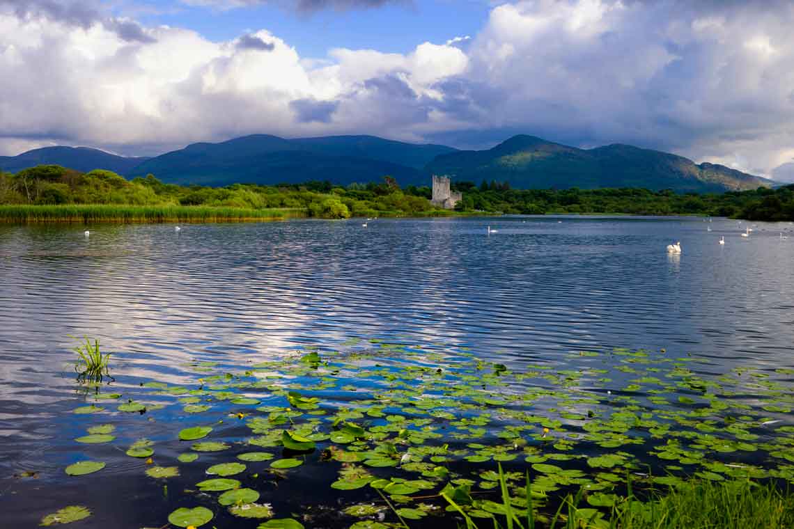
Enjoy majestic views over the lakes of Killarney
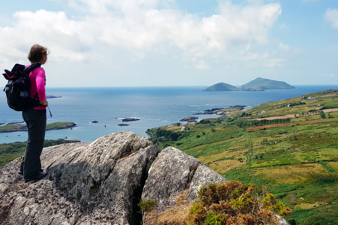
Experience the raw, unspoilt beauty of the Iveragh Peninsula and Kerry’s dramatic Atlantic coastline
Explore remote valleys and charming villages along the Kerry Way
Look out for Ireland’s only herd of native red deer in the beautiful Killarney National Park
The Kerry Way
Self-guided walking holiday with luggage transportation
Discover the raw and unspoilt beauty of Ireland’s Atlantic coastline on The Kerry Way; a 210 km circular walking route starting and finishing in the lively tourist hub of Killarney. The trail follows a similar route to the world-famous Ring of Kerry driving route but passes through remote valleys that are inaccessible by car. Of course, it also allows more time to appreciate the beauty of the Irish landscape as you walk along old green roads and historic tracks that have been travelled for hundreds of years.
The trail passes through varied landscapes, from the lakes of Killarney to forests, remote moorland and mountain passes. Although County Kerry is home to Ireland’s highest mountain range, Macgillycuddy’s Reeks, the Kerry Way mostly follows along the lower slopes of the Reeks before looping out around the Iveragh Peninsula, a region of wild, natural beauty steeped in history and legend, all the while with spectacular views to the stunning Kerry coastline and Atlantic Ocean.
This Kerry Way self-guided walking holiday is available as a 6-day or 11-day trip.
| 6 DAYS / 5 NIGHTS | €630 per person sharing
Killarney – Black Valley – Glencar – Glenbeigh – Cahersiveen – Depart |
||||||||||||
| 11 DAYS / 10 NIGHTS | €1,099 per person sharing
The complete Kerry Way, starting and ending in Killarney |
||||||||||||
| SINGLE SUPPLEMENT | An additional single supplement charge will apply to walkers booking single accommodation (a room for one person). | ||||||||||||
| ACCOMMODATION | The B&Bs on this trip have been carefully selected for their location, comfort and character. They all offer a warm Irish welcome to walkers, as well as a hearty breakfast to set you up for your day ahead. All rooms have en suite bathrooms. | ||||||||||||
| AVAILABILITY | You can start this trip on any day of the week, subject to availability, between March and October. | ||||||||||||
| INCLUDED |
|
||||||||||||
| NOT INCLUDED |
|
||||||||||||
| EXTRAS | If you’d like to break up the walk by staying an extra night at any location during your trip, just let us know. | ||||||||||||
| DIFFICULTY | Terrain consists mainly of quiet tarmac roads, open moorland, woodland and field paths and boreens. Some sections of the open moorland can be very isolated, and off-road sections can often be wet and muddy. There are no great ascents on this route but there are some long and challenging days. | ||||||||||||
Day 1: Arrive in Killarney and overnight
Killarney is the main tourist hub in Ireland’s south west and the gateway to Killarney National Park.
Day 2: Killarney to Black Valley
Distance: 24 km | Ascent: 380 m | Approximate walking time 6 hrs
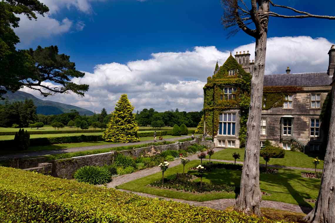
Leaving the town of Killarney, you will quickly find yourself in the tranquil surroundings of Killarney National Park. The park is home to Ireland’s only herd of native red deer, as well as several white-tailed eagles, flourishing since their recent reintroduction. You will pass through the grounds of the historic Muckross House & Gardens and on past Torc Waterfall.
A steep climb from here leads you out of the forest and into open moorland. You follow the Old Kenmare Road; a track over the mountains long closed to traffic with superb mountain views. Finally, you descend through another forest to reach the idyllic Upper Lake, where there is the opportunity to stop for some refreshments at Lord Brandon’s cottage before continuing on to the scattered rural community of the Black Valley.
Day 3: Black Valley to Glencar
Distance: 22/28 km | Ascent: 600 m | Approximate walking time 6-7 hrs
Today you will pass through a spectacular mountain landscape in some of Ireland’s most rugged countryside, where sheep outnumber humans. You will walk along boreens (small, quiet roads), forest trails and mountain paths, passing Cummeenduff Lough and Ireland’s highest mountain, Carrauntoohil (1,039m).
Cooky Monsters Café is an ideal halfway stopping point for toasted sandwiches and homemade ice cream, much-needed energy food before you tackle the steep climb out of the Bridia Valley. As you reach the top of the mountain pass you are rewarded with stunning views of Lough Acoose and the Dingle Peninsula beyond. The path descends steeply into the Derrynafeana Valley, before turning through a forest and then joining a tarmac road for for 1 km to the Climbers Inn in Glencar. If you are staying at Blackstones House, your hosts will be happy to pick you up from the Climbers Inn. Alternatively, you can walk the additional 6 km along lovely forest and riverside paths.
Day 4: Glencar to Glenbeigh
Distance: 13 km | Ascent: 200 m | Approximate walking time 5 hrs
An easier day today, following tranquil forest paths before ascending to the Windy Gap, where you will enjoy spectacular views of Rossbehy Point, Inch Strand and the Dingle Peninsula. From there it is downhill all the way to Glenbeigh, a welcoming seaside village with great old pubs and a lively traditional music scene.
A longer variant is also available, which takes you around the flank of Seefin mountain, with great views over Lough Caragh to Macgillycuddy’s Reeks beyond.
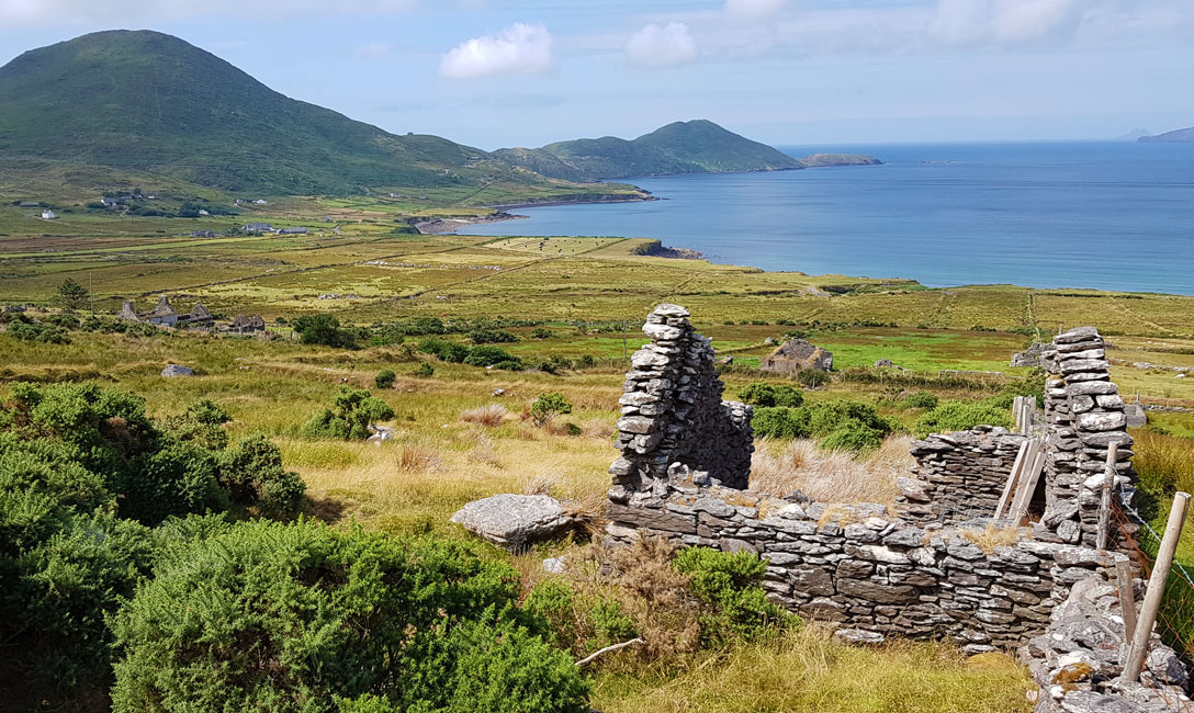
Day 5: Glenbeigh to Cahersiveen
Distance: 21/31 km | Ascent: 300 m | Approximate walking time 5/7 hrs
The first coastal stretch of the Kerry Way. You leave the village of Glenbeigh, crossing the Behy river before starting your climb, initially through Behy forest and then following an old coach path around the slopes of Drung Hill. You will enjoy magnificent panoramic views over Rosbeigh Beach and across Dingle Bay to the Dingle Peninsula.
Continuing a long the old coach path, you pass high above an old railway viaduct before descending into the Ferta valley to Foilmore. A pickup can be arranged here to take you to your overnight accommodation in Cahersiveen, otherwise contiune for another 10 km through quiet farmland.
If you wish to stay for an extra night here, Cahersiveen makes a great base for visiting Valentia Island or the UNESCO World Heritage Site island of Skellig Michael.
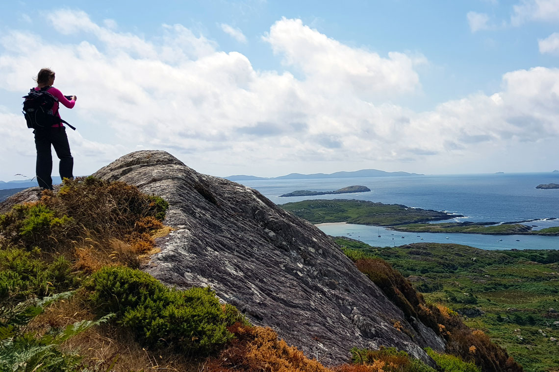
Day 6: Cahersiveen to Waterville*
Distance: 22 km | Ascent: 350 m | Approximate walking time 7 hrs
After breakfast, you will be transferred back to the Kerry Way.
Today’s walk mostly follows moorland paths, along two undulating mountain ridges. Your first gradual climb takes you to the top of Knockavahaun (371m), where you will be rewarded with magnificent views of Valentia Island and the western end of the Iveragh peninsula. This is followed by some sections on quiet country roads, before climbing to another mountain ridge, overlooking Ballinskelligs Bay and Lough Currane.
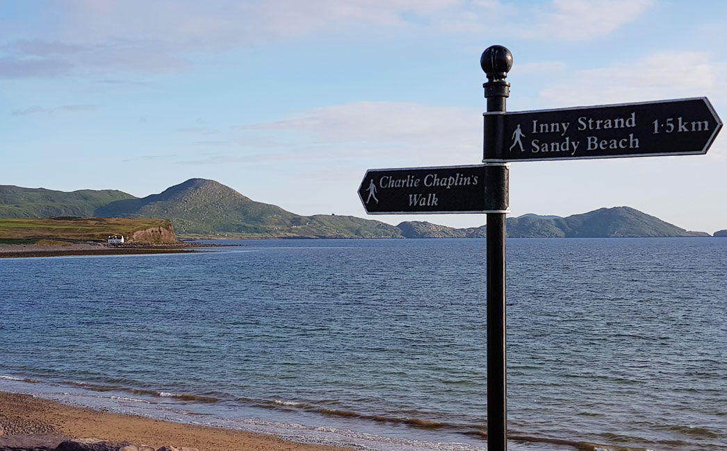
A steady descent takes you into the colourful seaside village of Waterville, where a bronze statue of Charlie Chaplin greets you on the promenade. Chaplin was a regular visitor to Waterville and the town hosts the annual Charlie Chaplin Comedy Film Festival in his honour.
*If you have booked the 6 day tour your arrangement comes to an end this morning after breakfast. There is a regular bus service from Cahersiveen to Killarney during the summer months. From Killarney, you can continue on to Dublin by bus or by train. We will provide you with full details and timetables.
Day 7: Waterville to Caherdaniel
Distance: 13 km | Ascent: 350 m | Approximate walking time 4 hrs
A relatively short section today, along a wonderfully scenic route that ranks among Ireland’s most beautiful coastal walks. The path follows a mixture of laneways and mountain trails, past ancient stone-walled field patterns and ring forts above Derrynane Bay.
There is an option of taking a short detour to visit Derrynane House and Gardens, the ancestral home of Daniel O’Connell, Ireland’s ‘Great Liberator’.
Day 8: Caherdaniel to Sneem
Distance: 18 km | Ascent: 440 m | Approximate walking time 5 hrs
Today’s route follows the “Old Butter Road” that was used in the 19th century to transport butter to Cork. You follow rocky trails upwards through sheep country to reveal spectacular views across the inlet of Kenmare to the Beara peninsula. A short detour today will take you to the 3rd century Staigue ringfort.
Day 9: Sneem to Kenmare
Distance: 31 km | Ascent: 650 m | Approximate walking time 8 hrs
This is a long but relatively easy section, with no major ascents. It follows the rocky shoreline of Kenmare Bay, along rural roads and lowland mountain trails and passes through the forest and estate of Dromore Castle, before descending into the colourful and elegant town of Kenmare.
Day 10: Kenmare to Killarney
Distance: 26 km | Ascent: 600 m | Approximate walking time 7 hrs
This scenic final section leaves the coast and takes you up into the hills and then back through the oak forests of Killarney National Park, with views across the lakes.
Celebrate with a hearty meal and a well-earned drink in one of Killarney’s many traditional pubs.
Day 11: Depart Killarney
Bus and train services from Killarney are excellent and we will provide you with all the travel details you will need to get you back to the airport or on to your next destination.
Getting to and from Killarney


Tour Reviews
Ring of Kerry er fantastisk.. Vi tog den store pakke og rundede de 200 km til fods. Alt det praktiske klappede, så vi gik kun med dagrygsæk. B&B var velvalgte og alle vi mødte var virkelig venlige. Eventyrlig natur… super tur.
Leave a Review